Find Us
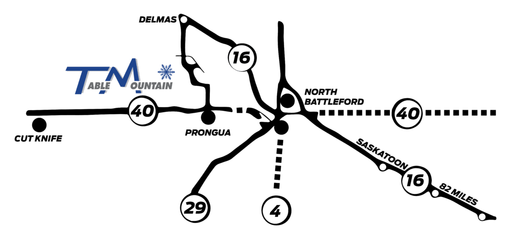
Via Hwy 40
Table Mountain is located 16 km west of Battleford or 29 km east of Cut Knife on Highway 40, then 9.5 km north and west on a grid road. Do not use Google Maps as it will not take you on the proper route!
Via Hwy 16
Table Mountain can also be reached by turning off Highway 16 at Delmas and traveling 14.5km south on grid road.

- GPS Coordinates: Latitude 52.815213° Longitude -108.604789°
- Phone: 306-937-2920
- Fax: 306-937-3688
- Mailing Address: Table Mountain Regional Park Box 343 North Battleford, SK S9A 2Y3
- General Inquiries: admin@tablemountain.ca
- Snow School/Lessons: admin@tablemountain.ca
- Table Mountain Ski Club Inc.
- Flatland Freestylers
- Snowboard Club

| Mountain Statistics | |
|---|---|
| Vertical Drop: | 360 ft (110 m) |
| Skiable Area: | 45 acres (18 hectares) |
| Snowmaking: | 99% |
| Number of Lifts: | 4 |
| Uphill Lift Capacity: | 3,800 per hour |
| Types of Lifts: | 2 Magic Carpets, 2 Quad Chairs |
| Number of Trails: | 11 |
| Longest Run: | 3,600 ft (1,097 m) |
| Alpine Skiing: | Yes |
| Snowboarding: | Yes |
| Night Skiing: | Yes |
| Restricted Areas: | No |
| Heli-Skiing: | No |
| Leash Required: | Yes |
| Snowcat Skiing: | No |
| Cross Country: | No |
| Snow Tubing: | No |
| Area Services | |
|---|---|
| Child Care: | No |
| Adaptive Skier: | Yes |
| Lessons: | Yes |
| Rentals: | Yes |
| Children’s Program: | Yes |
| Women’s Program: | Yes |
| On Hill Lodging: | No |
| Trail Ratings | |
|---|---|
| Easiest: | 40% |
| More Difficult: | 50% |
| Most Difficult: | 10% |
Trail ratings indicate the relative difficulty of the runs within a given ski area and are not meant to be used for comparison between ski areas.
| Parks & Pipes | |
|---|---|
| Terrain Park: | Yes |
| Moguls: | Yes |
| 1/4 Pipe: | No |
